


Introduction
The hydrological systems freely extend beyond the national borders and waters can spread rapidly with potential of any pollution.
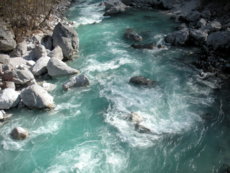
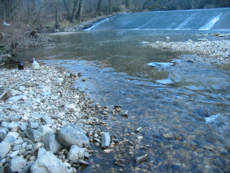
An example of such pollution may be a spillage of hazardous substances into the Soča River on Slovenian or Italian territory. As a matter of fact, the Sočariver provides water for an alluvial aquifer from which water is drawn to supply Trieste and its surroundings in Italy, as well as partially a Karst aquifer supplying drinking water to five municipalities in the Karst region and three municipalities in the Coast region of Slovenia. The Sočariver flows into the Adriatic Sea in the vicinity of Trieste which is why a pollution of the Soča river may represent a potential pollution of the sea in the Gulf of Trieste. In addition, the sources of drinking water may supply drinking water for settlements on both sides of the border.
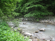
Such example is the spring and the water system Mrzlek which is in fact the greatest water distribution system in the Goriška statistical region. It supplies drinking water to residents in the territory of the Nova Gorica City Municipality, Šempeter-Vrtojba Municipality and Renče-Vogrsko Municipality in Slovenia and residents of the Gorizia Municipality in Italy.
For the above mentioned reasons and in terms of the management of the sources of drinking water, the cross-border area must be treaded as a uniform system, and activities for its proper and timely protection must be planned by common action.
Purpose and goals
The purpose of a three-year long project is to establish a uniform cross-border action system for the Civil Protection Service in cases of hazards posed to the sources of drinking water owing to technological risks and natural disasters and thus contribute to the development of new information and communication technologies and sustainable territorial integration and preservation of environment in the areas of Goriška statistical region, Obalno-Kraška statistical region, Gorenjska statistical regions and Autonomous Region of Friuli Venezia Giulia.
Hydrological systems are not limited by state borders, the impacts of pollution may freely spread across the borders that is why their integrated management by means of cross-border coordination is necessary.
For the Civil Protection Service an algorithm of action, harmonised by cross-border players, will be developed which will be supported by means of the GIS (Geographic Information System) regarding the sources of drinking water. This algorithm of action will be an important functional tool for immediate and efficient action of all institutions and bodies involved in the cases of intervention. A key achievement of the project will be an upgrade and improvement of the GIS system with a hydrological model for the Karst aquifer of the Trnovo-Banjščice Plateau and the alluvium of the Soča (Isonzo) River being the main common source of drinking water for the cross-border region of Gorica (Gorizia)-Trieste and a spatial decision support system ((DSS/SDSS) based on the analysis of indicators regarding the impact of the soil use to the sources of drinking water.
With the harmonisation of hydro-geological expert bases and by means of testing various possible scenarios in regard to the pollution of the sources of drinking water in case of incidents, assisted with coordination, and by enhancing common monitoring, supervision and provision of prevention measures in areas of increased risk, the hazard of pollution of drinking water, the Soča river and the sea in the Gulf of Trieste will be limited in the cross-border area.
The envisaged activities involving cooperation of partners on both sides of the border, which will include the exchange of know how and information and the establishment of a co-ordinated Geographic Information System (GIS) and the algorithm of action for the Civil Protection Service in cases of hazards posed to the sources of drinking water, will result in an enhanced territorial cohesion within the functional cross-border areas. The uniform GIS system of the sources of drinking water developed for cases of emergency will be upgraded and improved by a hydro-geological model and a decision support system which will be based on an analysis of indicators demonstrating impacts of the use of soil to the sources of drinking water and it will be an important functional tool for fast and efficient action taken by all institutions and authorities deployed for intervening in cases of hazards posed to the sources of drinking water. This will contribute to the common prevention of consequences of natural disasters and technological risk in the areas of Goriška, Gorenjska and Obalno-Kraška statistical region and the Autonomous Region of Friuli VeneziaGulia.
The results of the hydro-geological research will be used in operational procedures aimed at protecting the sources of the drinking water within the system of the Civil Protection Service of both cross-border areas. This will contribute to further transfer of basic research into practice. A network of partners will be formed to contribute to the improvement of the communication system between disciplines and across the border.
Results
- The developed uniform algorithm of action covering the cross-border area for the Civil Protection Service in cases of hazards posed to the sources of drinking water in cases of incidence and emergency situation.
- The developed joint GIS system regarding the sources of drinking water for the Region of Friuli Venezia Giulia, Goriška statistical region, Gorenjska statistical region and Obalno-Kraška statistical region upgraded with a hydrogeological models for the aquifer of the Trnovo-Banjšice Plateau and the alluvium of the Soča River and improved with the methods relating to spatial analysis and environment management for Soča plain.GIS is a tool for rapid identification of risk sources and planning of measures in cases of emergency protection.
- Elaborated guidelines for development of the spatial decision support systems(SDSS) for reduction of anthropogenic impact on the aquifers.
- Elaborated guidelines for monitoring of karstic water sources quality in regular and emergency situations.
- The introduced COLILERT and ENTEROLERT method for fast microbiological water testing.
- The developed common project portal.
- Presentation and publication of results to the public.
Project duration: 2.11.2011 – 2.11.2014
Project value: 1.349.300,17 EUR
Workpackages
- WP1 Project coordination and management
- WP2 Preparatory activities
- WP3 Common Project Portal
- WP4 Algorithm of action
- WP5 GIS of the sources of drinking water
- WP6 Hydro-geological upgrade and improvement of the GIS of the sources of drinking water
- WP7 Amendment of the GIS system with methods relating to spatial analysis and environment management
- WP8 Introduction of methods COLILERT and ENTEROLERT
- WP9 Communication plan: presentation to the public and publication of the results achieved

Project partners

Contact
NIJZ OE Nova Gorica
Vipavska cesta 13
Rožna Dolina
5000 Nova Gorica
Tel. +386053308612
Statement
The web site is co-financed with funds from the European Fund for Regional Development within the scope of the Slovenia-Italy Cross-Border Cooperation Programme 2007-2013 and national funds.
The responsibility of the content of the web site is exclusively held by the author: NIJZ OE Nova Gorica.
Link to Program http://www.ita-slo.eu